GEOCHANGE
Control the evolution of your geographic data

Benefits
- Automatic detection and description of territorial changes
- Monitoring the evolution of territories over time
Key words
- Management of geographic data changes
- Open data
- Geographic divisions
- Linked Open Data Web
Laboratory
- LIG
Institutions
- CNRS
- GRENOBLE INP-UGA
- INRIA
- UGA
Linksium Continuum
- Maturation
Context
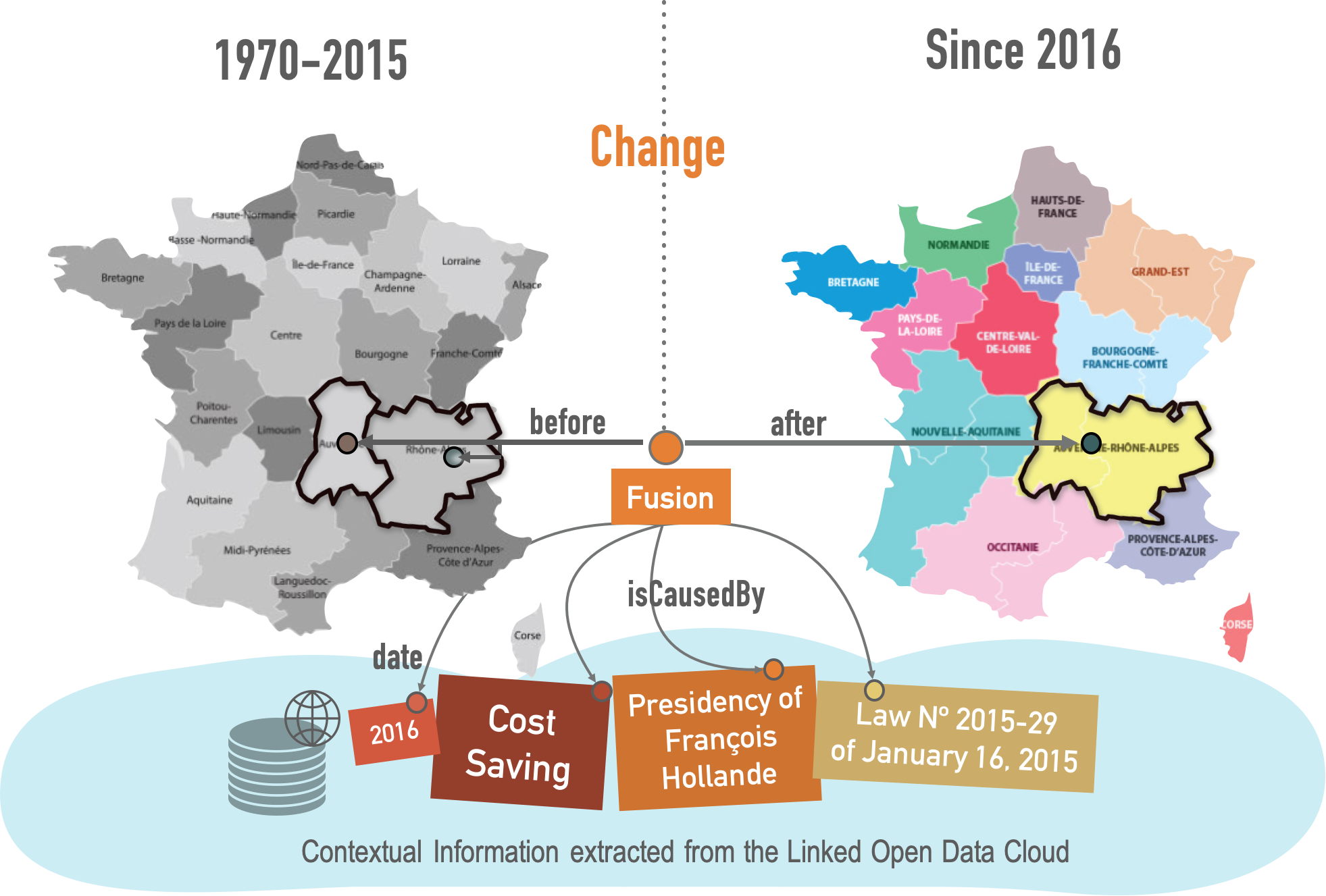
The GeoChange projects goal is to develop and distribute a software designed for any producer or user of geographic divisions (into regions, departments, municipalities or districts for instance) facing the problem of evolution of these data over time.
Technology
GeoChange creates knowledge graphs describing territorial changes, using a specific algorithm developed by the Geochange team. This algorithm computes the similarities between two versions of a geographic division and describes the detected changes using tags such as "fusion" or "merge".
Advantages
GeoChange automates the creation of catalogs that list territorial change descriptions. It is a decision-making tool that allows experts, professionals or elected officials to visualize and better take into account the evolution of territories over time. GeoChange may also be used in order to inform citizens about past policies and assist them in their upcoming projects.
State of progress
A prototype has been developed and successfully tested on several datasets from official statistical agencies of the European Commission, Switzerland and Australia. Expressions of interest in the approach are coming from the OGC and local authorities.
Applications
GeoChange enables professionals, citizens or computer programs to consult catalogs of changes that occurred in various geographic divisions along time, such as cadastral boundaries, land use, land cover, electoral boundaries (evolution of American districts, for instance), administrative boundaries (municipalities, school districts, ...).
Featured articles
 SERIAL TECH TRANSFR
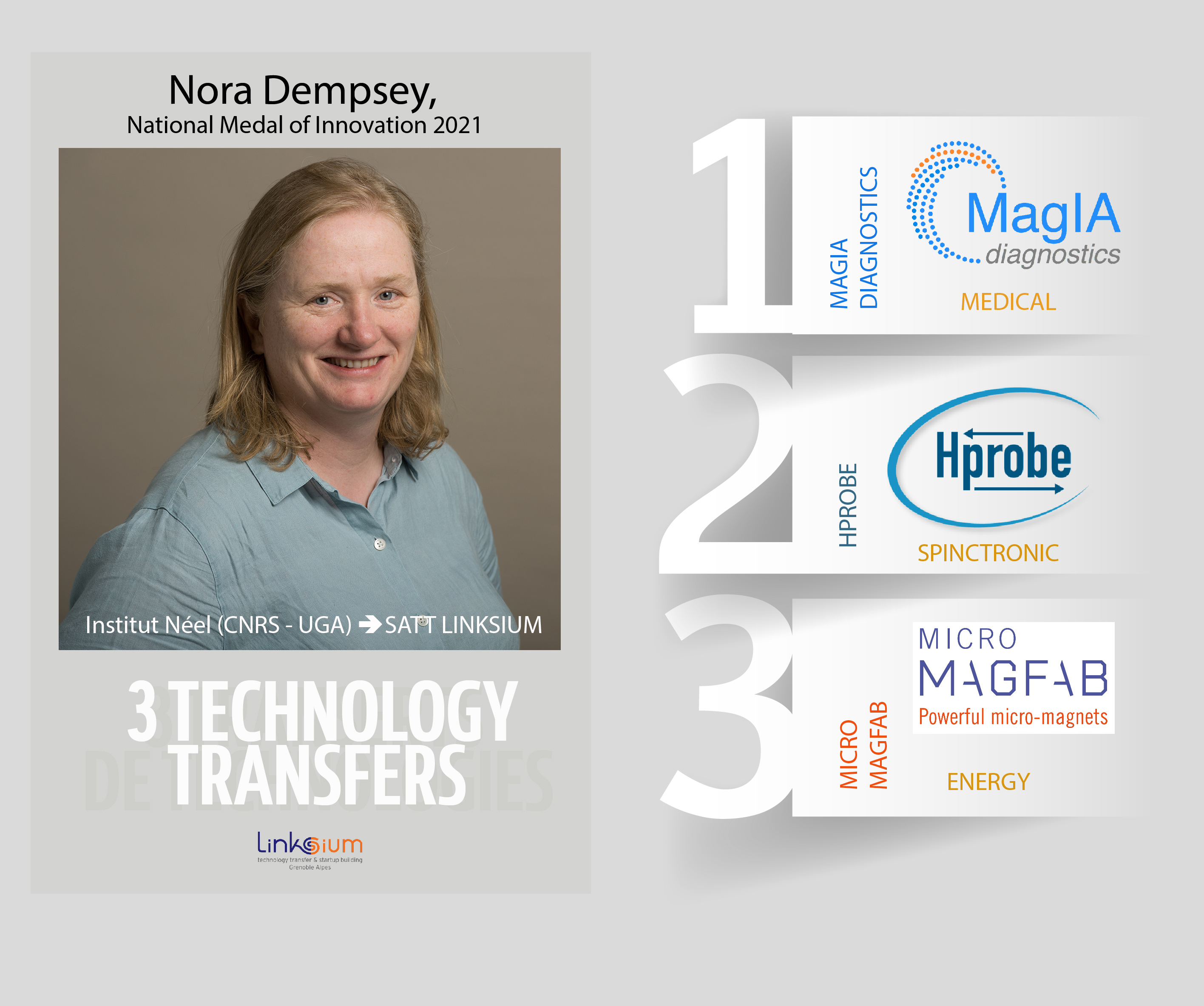
1, 2 and 3 startups for Nora Dempsey, National Medal of Innovation 2021
Nora Dempsey is one of the four winners of National Medal for Innovation 2021 awarded by CNRS. Nora Dempsey, born in Ireland, has gained an international recognition for her research in Grenoble on...
Read the article PORTRAIT
Amiral Technologies, la startup IA grenobloise spécialisée dans les solutions de maintenance prédictive, intègre Station F
An ambitious promise: to invent a zero-defect and zero-downtime future for industry. Amiral Technologies, a startup co-founded and boosted by Linksium, based on the technological prowess of the Gre...
Read the article